“Five Months, Perhaps Six”: The Voyage Out from England to the Cape
Why the road to India ran almost to Brazil, and what it was like to spend four months at sea in 1813.
Early in By Trade and by Trust, Charles Bingley sits on the deck of Constance, seven days out from Newcastle, and works out what the voyage ahead will mean:
They were to be at sea together for five months, perhaps six. For that time, his society must be confined within a very narrow compass: Constance and her thirteen souls, the Atlantic, and beyond it the Indian Ocean, with the slow and continual settling of the timber below, like something content to remain where it had been placed.
Five months to India sounds like an age now. In 1813 it was simply how long it took. In Part 1 we met the Company that ruled the road east. This time we follow a ship down it, as far as the Cape of Good Hope: which way she went, why, and what life was like on board.
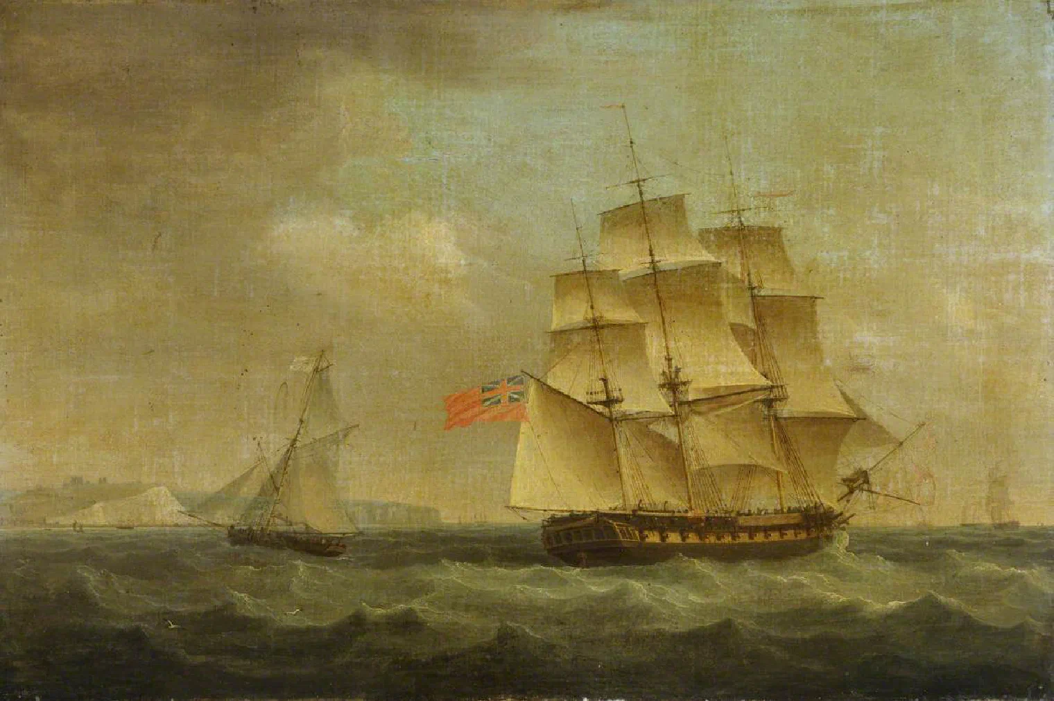

Two kinds of ship
Most people who went to India in 1813 went in an East Indiaman: one of the big ships the East India Company hired, season after season, to carry its trade. They were the largest merchant ships of their day, usually 1,100 to 1,400 tons, armed with cannon, and crewed by well over a hundred men. They carried the Company’s cargo, its soldiers and its young officials, and any passenger who could pay.
Constance is not one of these. She is a private ship belonging to Bingley’s own firm, carrying timber and iron, with eleven men, a mate and a captain. Ships like her were smaller, slower, cheaper and much plainer. There was no great cabin full of fellow passengers, just a berth and a narrow desk for the one gentleman aboard.
The route, though, was the same for both. The wind decided it.
The long way round
Look at a map and the shortest way from England to the Cape is straight down the coast of Africa. No sailing ship went that way. Near the African coast the winds and currents were against them, and the shore was dangerous.
Instead, a ship went the long way round, following the great wheel of winds that turns over the Atlantic. The General East India Guide, a handbook for travellers to India, put it plainly in 1825:
Many vessels proceed down the Atlantic in a mid direction, between the Azores and the Canaries, till they catch the trade-winds … They then stretch over to the coast of Brazil, along which they run to about 30° south … Being now in the way of variable winds, they shape their course towards the Cape of Good Hope.
In plain words:
- Down the Channel and across the Bay of Biscay, which had a bad name for storms. (Constance is “approaching the Bay of Biscay” a week out.)
- South past Madeira or the Canaries, often the first land seen since England.
- Into the north-east trade winds, steady winds that carried a ship south-west towards the equator.
- Through the doldrums, a belt of calms and squalls near the equator where a ship could sit for days with her sails hanging.
- Across “the Line” (the equator) and on towards Brazil, sometimes in sight of its coast.
- South, then east, picking up the westerly winds of the far south and running before them to the Cape.
The ship sailed a great curve, almost touching South America before swinging back to Africa. It looks absurd on a map, but it was the fastest way.
How long did it take?
It depended on the season, the ship and the luck. The Guide says a ship leaving England in the autumn would “reach Madras generally in from eighteen to twenty weeks”. For the Cape alone, it speaks of passengers fresh from “a confinement within such narrow limits, probably for ten or twelve weeks”.
Constance takes longer. When the cry of “Land” goes up and Table Mountain appears, Bingley counts:
A hundred and fifteen days.
Nearly seventeen weeks to the Cape is slow but not strange for a heavily laden timber ship, and Bingley has the Indian Ocean still ahead. All told, he reaches Calcutta eight months after leaving Newcastle.
Life on board
Where you slept
On an East Indiaman, a passenger’s comfort depended on what he could pay. The Guide gives some prices. Cabins at the stern, with a window, belonged to the captain to sell, and “a slip, including one window, may produce from £200 to £300”. That is more than a curate earned in a year. Poorer passengers took a bed-place in the “steerage”, an open passage “totally devoid of privacy; exposed to violent currents of air, not always of the sweetest odour”.
In wartime, as 1813 was, cabin walls were often made of canvas, so that they could be rolled up if the ship had to clear for action and run out her guns. The best bed was a cot, a canvas box hung from the beams, which swung level as the ship rolled and so was kinder to anyone prone to seasickness.
What you ate
At the captain’s table, surprisingly well, at least at first. Fresh meat ran out after a week, but a large ship carried live animals: “a small flock of sheep, perhaps from twenty-five to forty in number”, kept on hay on the deck above, and coops of chickens and ducks. Dinner was at two, announced by a drum playing “The Roast Beef of Old England”, “though it rarely leads to a participation of that viand”. The butter, the Guide admits, “cannot be highly praised”, since in the tropics it melted “so as to resemble liquid honey”.
The crew ate much plainer food: salt beef and pork, hard ship’s biscuit, dried peas, oatmeal, cheese, and water that grew staler the longer it sat in the casks. On a small ship like Constance, the gentleman passenger would not have eaten very differently from the men.
What could go wrong
Scurvy was the great fear on any long voyage. It came from going without fresh fruit and vegetables, and it could kill. The Royal Navy had issued lemon juice to its sailors since 1795, but merchant ships were not obliged by law to do the same for decades afterwards. A careful captain took on fresh food wherever he could.
The enemy was the other danger. Britain was at war with France, and from 1812 with the United States too. Privateers hunted merchant ships, and in wartime ships were expected to sail together in convoys guarded by warships, unless they held a licence to sail alone.
The weather was the third: gales in Biscay, calms in the doldrums, and the heavy seas of the far south.
How you passed the time
Slowly. Passengers read, wrote letters they could not send, played cards, fished, and walked the deck. On Sundays the captain read the church service. Bingley, in the book, sleeps “more than he had for many months” and sets himself to learn the name of every man aboard before they reach the Cape.
Crossing the Line
The great event of the voyage was crossing the equator. Anyone who had never crossed it before had to be “introduced” to King Neptune. Thomas Williamson, who made the voyage himself, describes it in his East India Vade-Mecum (1810):
About noon, the boatswain, being full dressed as the god of the ocean, is supposed to hail the ship, enquiring whence she comes? whither she is bound? and if any persons are on board who never before crossed the great boundary dividing the northern from the southern hemisphere?
Neptune’s wrath could be bought off. Williamson says a passenger could escape with a gift to the crew of “from two to three gallons each, of good rum or gin”. Those who could not pay, usually the new sailors and soldiers, were soaked with buckets of water, and sometimes lathered with tar and “shaved” too. Williamson calls it “filthy in the extreme” but admits it could not be “witnessed without exciting much laughter”.
Finding the way
How did a ship know where it was, in the middle of the ocean? Latitude, how far north or south, was easy: you measured the height of the sun at noon. Longitude, how far east or west, was much harder.
By 1813 there were two ways. One was the lunar distance, a long calculation from the angle between the moon and a star. The other was the chronometer, a very accurate clock that kept London time, so that comparing it with local noon gave the longitude. Chronometers were expensive, but the East India Company had been among the first to use them widely, from the 1790s. A small private ship might still rely on careful dead reckoning: speed, direction and time, written up every day.
Land
After months of grey sea, the sight of land was unforgettable. Here is how the book has Bingley see Table Mountain:
Then the cloud shifted, and something emerged from beneath it: a long, level darkness, too regular to belong to the sea, too fixed to be mistaken for weather.
Nearly every ship bound east stopped at the Cape. Why it did, and what it found there, is the next part of the series.
By Trade and by Trust is Volume Two of By Patience and by Paper. You can find it here.
Next in The Road East: The Cape of Good Hope, on Table Mountain, the seals, and why nearly every ship called there.
Sources and further reading
- Thomas Williamson, The East India Vade-Mecum, vol. 1 (London, 1810). The source of the quotations from Williamson in this post. Project Gutenberg.
- J. B. Gilchrist, The General East India Guide and Vade Mecum (1825), based on Thomas Williamson’s East India Vade-Mecum (1810). Sections 2 (passage, cabins, food), 4 (length of passage), 11 (the course) and 12 (crossing the Line, the Cape). Edited online by Frances W. Pritchett, Columbia University.
- Centre for Competitive Advantage in the Global Economy, University of Warwick, “The marine chronometer: a key to global transformation” (2025).
- Encyclopaedia Britannica (1911), “Convoy”, on convoys in the French wars. Wikisource.
- Royal Museums Greenwich, The East Indiaman Caesar, by Thomas Whitcombe.
- Wikipedia, for quick overviews: East Indiaman, Trade winds, Doldrums, Line-crossing ceremony, Scurvy, Marine chronometer, Lunar distance.
Comments
No account needed. Give a name, or leave it blank to post as Anonymous. Comments appear once the author has read and approved them.
Loading comments…